
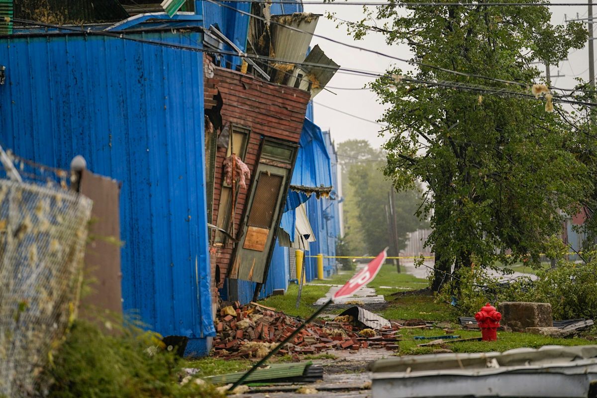
Detroit municipal authorities are actively grappling with the destructive aftermath of a severe weather system that tore across the city's east side earlier this month, leaving at least 101 properties damaged in its wake. In the latest assessments released by local officials, nearly a dozen of those battered buildings sustained structural damage so catastrophic that they are currently slated for potential emergency demolition to protect public safety.
The rapid property evaluations come as emergency response teams and municipal maintenance crews continue intensive cleanup operations following the storm. According to survey reports, nine specific structures throughout the affected corridors suffered such severe compromises to their integrity that rapid teardowns may be required to prevent hazardous collapses and clear the way for wider community recovery efforts.
Meteorologists with the National Weather Service officially confirmed that the destructive whirlwind was an EF2 tornado that touched down on September 3. The event marked a rare and sobering milestone for the region, representing the very first tornado confirmed to have struck within the Detroit city limits since 1997, ending an absence of nearly three decades of direct tornadic impacts in the urban core.
The twister concentrated its fury along a swath of established east-side residential communities. City inspectors identified the hardest-hit neighborhoods as McDougall-Hunt, Islandview, West Village, Indian Village, East Village, and Pingree Park. In these historic and densely settled quarters, high-velocity winds sheared through residential roofs, tore down mature trees, and left streets littered with structural debris.
In direct response to the unfolding crisis, Detroit Mayor Mary Sheffield moved swiftly by signing an executive order on September 4 to officially declare a local state of emergency. The formal declaration granted municipal agencies immediate flexibility and enhanced administrative authority to deploy heavy machinery, accelerate emergency cleanup work, and channel public resources directly into the most devastated sectors of the municipality.
The mayor’s emergency decree precisely delineated a geographic zone centered on the tornado’s primary path. The designated emergency boundary encompasses the area bordered by Sylvester Street to the north, East Jefferson Avenue to the south, Chene Street to the west, and McClellan Avenue to the east, while also extending municipal disaster protocols to include the entirety of Belle Isle.
Securing this official emergency framework allows city leadership to broaden its operational reach and coordinate comprehensive resident support initiatives. Furthermore, the local declaration serves as a crucial administrative prerequisite, empowering municipal officials to open high-level discussions with Michigan state authorities and federal emergency management agencies regarding potential financial disaster relief and recovery grants.
Beyond the residential pockets, one of the city's premier public recreation areas suffered immense environmental destruction. Belle Isle, Detroit's iconic island park located in the Detroit River, bore a heavy blow from the EF2 winds. Park grounds were left blanketed in debris, with massive fallen trees, severed branches, and torn shrubbery blocking pathways and requiring dedicated restoration teams to clear the grounds.
The storm’s fury also caused damage to regional architectural heritage. At the historic Ford Piquette Plant, violent wind gusts dislodged original masonry, causing historic bricks to plummet from the upper facade of the structure. Specialized restoration workers were promptly dispatched to install large plastic membrane sheets over the exposed sections to safeguard the landmark building against further moisture intrusion.
The severe storm complex that spawned the tornado was not confined strictly to Detroit's municipal borders, sending destructive squalls through adjacent suburban communities across the metropolitan region. In Madison Heights, aerial photography and ground surveys documented extensive damage along Groveland Street near University Avenue and 11 Mile Road, where powerful winds uprooted large trees and damaged neighborhood property.
Regional infrastructure was severely strained as the storm system whipped through Oakland and Wayne counties, triggering widespread power outages and hazardous road conditions. In Southfield, falling trees struck overhead power lines, producing dramatic electrical sparks that severed utility connections. Utility workers and local emergency responders worked continuously to isolate electrical hazards and restore power to impacted neighborhoods.
Back on Detroit's east side, residents and local volunteers have banded together in the wake of the disaster to assist neighbors with initial cleanup tasks. As chainsaw crews work to cut up downed timber and clear impassable residential roads, municipal teams are focusing on hauling away massive piles of brush and storm debris that line neighborhood curbsides.
Municipal building safety inspectors are continuing to conduct door-to-door structural analyses to finalize the status of the 101 damaged properties. For the nine structures earmarked for possible emergency demolition, engineering teams are weighing whether any stabilization is feasible or if immediate demolition remains the only responsible recourse to protect adjacent homes and passing pedestrians.
As recovery efforts advance, city administrators remain focused on stabilizing affected neighborhoods and securing every available funding stream to assist displaced or impacted residents. The September 3 tornado serves as a stark reminder of nature's unpredictability, leaving Detroit to navigate a complex, multi-stage recovery after enduring its most significant urban twister in nearly thirty years.







(0)